OnTrails
道迷い防止・軌跡記録に最適なオフライン対応の登山GPSアプリです。
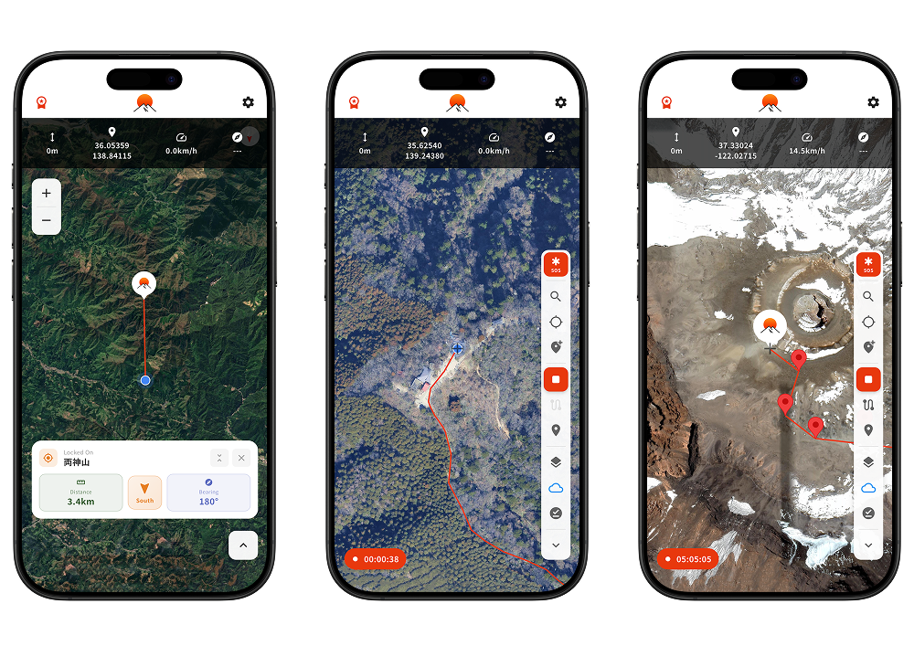
山奥でも現在地を正確に表示し、目的地への方角と距離をロックオン機能で把握できます。
歩いたルートは地図上に赤線で自動記録され、GPXファイルとしてエクスポートも可能です。
事前に地図をダウンロードしておけば、電波の届かない山岳地帯でもGPSナビゲーションが使えます。
Google Map、国土地理院地図、OpenStreetMapの3種類から地図を選択でき、海外トレッキングにも対応しています。
カスタムマーカーの登録や音声ガイダンス、緊急時の座標共有機能など、安全登山をサポートする機能を備えています。
紙の地図やコンパスと併用して、安全な登山をお楽しみください。
An offline hiking GPS app ideal for preventing getting lost and recording your tracks.
It accurately displays your current location even deep in the mountains, with lock-on navigation to track direction and distance to your destination.
Your hiking route is automatically recorded as a red line on the map and can be exported as a GPX file.
By downloading maps in advance, you can use GPS navigation even in mountain areas without cell service.
Choose from three map types—Google Maps, Geospatial Information Authority of Japan maps, and OpenStreetMap—with support for international trekking.
Features include custom marker registration, voice guidance, and emergency coordinate sharing to support safe hiking.
Please use this app alongside paper maps and a compass for a safe hiking experience.